The Countryside and Rights of Way Act 2000, when it comes into effect, will give people a new right to walk over large areas of open countryside and common land. It will also mean new responsibilities for those who visit and manage these areas.
The Act will not give people the 'right to roam' wherever they want to. It will, however, allow people to walk on access land throughout England and Wales, once these areas have been defined and opened for access. The new rights should come into force by 2005 at the latest. These rights will apply only on the following types of land:
• registered common land;
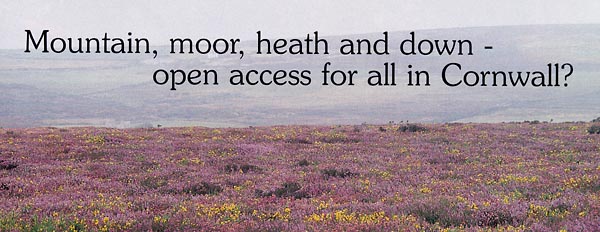
• land that is wholly or predominantly mountain, moor, heath or down (known in the Act as open country); and
• any land voluntarily dedicated by its owner for permanent access.
Intensive farmland such as arable land or improved grassland will not be mapped unless it is registered common land or forms part of a larger parcel of open country. Even within the areas shown on the access maps, some types of land will be excepted and unaffected by the new rights. These include land ploughed or drilled during the past year, crops, trees, quarries and other active mineral workings, golf courses, race courses and military areas where Ministry of Defence byelaws apply. There will also be restrictions close to homes and some farm buildings.
This land will be marked on official maps being produced by the Countryside Agency, and on other maps, like the Ordnance Survey's maps. There will be wide public consultation before maps are finalised.
Mapping open country and common land began in September 2002 for the south west - Cornwall, Devon and the Taunton Deane area of Somerset (maps relating to the north west and south east of England have already been drafted). The boundaries of open country will be based on a range of existing information (such as habitat surveys), supplemented where necessary by aerial photography or other new data. The Environmental Records Centre for Cornwall and the Isles of Scilly (ERCCIS) has already provided the Countryside Agency with digital maps of heathland, along with the land cover information for the whole of Cornwall for 1995.
The process of completing the map for the south west is likely to take about two years and will include:
• advance regional and local publicity
• preparation of draft maps (likely in spring 2003)
• wide public consultation
• issue of provisional maps (likely in autumn/winter 2003)
• an opportunity for landowners, tenants, etc. to appeal
• determination of appeals by the Secretary of State
• issue of conclusive maps - the legal record (2004)
Copies of the "draft maps will be displayed in public places such as libraries and local authority offices, and public meetings to explain the maps will be held throughout the area. The Countryside Agency aims to produce conclusive maps for the whole of England by autumn 2004, and it has a duty to review them at least every ten years.
'Access land' will be shown on the ground by a small symbol. Information boards at main points of entry will show people where they can go and give details about any current restrictions.
Most activities on foot, such as walking, sightseeing, bird watching, picnicking, climbing and running will be allowed on access land. The new rights do not include organised games and commercial activities, cycling or riding - though where they are currently allowed there is no change.
So get involved in the maps being produced for Cornwall, whether you own or manage land, or are just interested in which areas you will be allowed open access for recording. You can find out more about the mapping process and any proposed public meetings by phoning the Access Helpline: 0845 100 3298 or looking on the Countryside Agency's website: www.countryside.gov.uk /access/mapping.
Sarah Myles